Department of Remote Sensing and Geographic Information Systems (GIS)
Department of Remote Sensing and GIS is one the most important departments which has international collaboration with several departments such as department of Geoinformatics (Z-GIS) University of Salzburg, Austria, Department of GIS, San Diego State University (SDSU), California, United State, Department of Cartography and GIS, University of Tehran, Iran, Tokyo Institute of Technology, Japan. This is also one of the first departments offered postdoctoral position for international students.This department encourages international bachelor, master, PhD and postdoctoral applications.
The department offers B.A. and M.A. courses and plans have been made for further extension of the department toward Ph.D. This is one the first departments that offers very professional master program in Remote Sensing and GIS specialized in several fields.
Name: Dr. Bakhtiar Feizizadeh (Professor)

Email : feizizadeh@tabrizu.ac.ir
bakhtiar.feizizadeh@gmail.com
Tel :0413339-2295
PhD : Geoinformatics (Remote Sensing and GIS), University of Salzburg, Z-GIS, Salzburg, Austria
Scholar researcher, Department of Geography,San Diego State University (SDSU), California, USA
MSC: Remote Sensing and GIS, University of Tabriz
B.A: Physical Geography, University of Tabriz
Research interests: Land use/Land Cover Classification, Monitoring and Change Detection
Image Processing- Object Based Image Analysis (OBIA)
Thermal Remote Sensing
GIS Multicriteria Decision Analysis (MCDA)
Integration of Remote Sensing and GIS for Agricultural Crop Monitoring, Land Suitability Analysis and Crop Stress Drought
Remote Sensing and GIS Application for Geohazard Monitoring and Risk Assessment
Landslide Hazard Mapping Using GIS MCDA and OBIA
Sensitive and Uncertainty Analysis for GIS-MCDA
Spatial Data Infrastructure (SDI)
Name: Dr. Khalil Valizadeh Kamran (Professor)

Email : valizadeh@tabrizu.ac.ir
Tel :0413339-2295
PhD: Satellite based climatology, University of Tabriz
M.Sc: Remote Sensing and GIS, Tarbiat Modares University, Iran
B.A: Physical Geography, University of Tabriz
Research interests: Land use/Land cover Classification, Monitoring and Change Detection
Image processing
Thermal Remote Sensing
Remote Sensing and GIS Applied to Climatology
Remote Sensing and GIS Application for Geohazard Monitoring and Risk Assessment
SAR Image Processing
GIS Based Climatology
Name: Dr. Maryam Bayati Khatibi (Professor)

Email :m-bayati@tabrizu.ac.ir
Tel :0413339-6013
Educational background
PhD:Geomorphology, University of Tabriz
M.A:Hydroclimatology, University of Tabriz
B.A: Geography, University of Tabriz
Research interests: Geohazards, Risk Assessment and Mass Movements
Name:Dr. Abolfazl Ganbari (Professor)

Email : a_ghanbari@tabrizu.ac.ir
Tel :0413339-2265
Educational background
PhD: Urban Planning, University of Tabriz
M.A: University of Tabriz
B.A: Geography and Urban Planning, University of Tabriz
Research interests: Urban Planning
Name: Dr. Sadra Karimzadeh (Associate Professor)
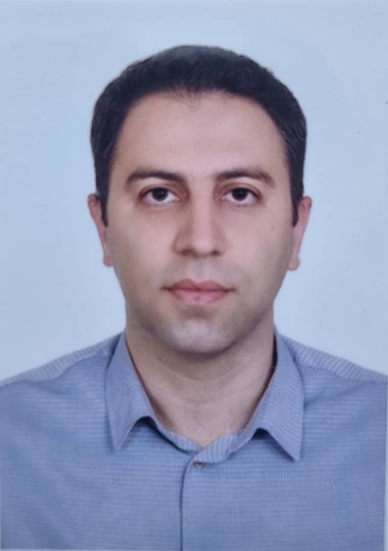
Email : sa.karimzadeh@tabrizu.ac.ir and sadra.karimzadeh@gmail.com
Tel :0413339-2296
Invited research scientist at Gebze Technical University, Turkey (2022-2023)
Researcher at RIKEN (Geoinformatics Unit), Japan (2019)
JSPS Postdoctoral Researcher: Tokyo Institute of Technology, Japan (2016-2018)
Ph.D: Remote Sensing Engineering, Kanazawa University, Japan (2012-2015)
Research interests: SAR Remote Sesning, InSAR, Earthquake damage detection, Site characterization, Soft computing
Website

Name: Dr. Mehrdad Jeihouni (Assistant Professor)
Email : jeihouni@tabrizu.ac.ir
Tel :0413339-2295
PhD : Remote Sensing & GIS, University of Tehran, Iran.
Potsdoctoral Researcher: Department of Remote Sensing and GIS, University of Tabriz, Iran.
MSc: Remote Sensing and GIS, University of Tehran, Iran.
BSc: Soil Engineering, University of Tabriz.
Research interests:
-
Remote Sensing & GIS
-
Digital Soil Mapping
-
Spatial Data Mining
-
Geo AI
-
Soft Computing

Name: Dr. Behnam Khorrami (Assistant Professor)
Room: 516
Tel :0413339-2287
Email : bekhorram@tabrizu.ac.ir
Adjunct Research Associate: Environmnetal Informatics & Modelling Lab, Izmir Institute of technology, Izmir, Turkiye
PhD : Geoinformatics (Remote Sensing and GIS), Dokuz Eylul University, Izmir, Turkiye
MSc: Remote Sensing and GIS, University of Tabriz, Iran.
BSc: Natural Resources Engineering, Urmia University, Iran.
Research interests:
- Remote Sensing of Environmnet
- Geospatial Analysis & Modelling
- Hydrological Monitoring
- Natural Hazards
Honors and Awards:
- Fully founded scholarship for PhD study sponsored by Turkiye Burslari of Turkiye (2016).
- YTB Academic Performance Award, Turkiye (2020).
- The Best PhD Thesis of the Year (2022) Award by Geoscience and Remote Sensing Society (GRSS) Turkiye.
- Distinguishd Graduation Award, Dokuz Eylul University, Turkiye (2022).
- Scientific Publications Award, Dokuz Eylul Universi, Turkiye (2022).
- TUM Global Postdoctoral Fellowship, Technical University of Munich, Germany (2024).
- Distinguishd Graduation Award, University of Tabriz, Iran (2016).
- Distinguishd Graduation Award, Urmia University, Iran (2012).

